Maqam [sheikh] Hasan ar-Ra‘i
مقام حسن الرعيعي
מקאם א-רעי
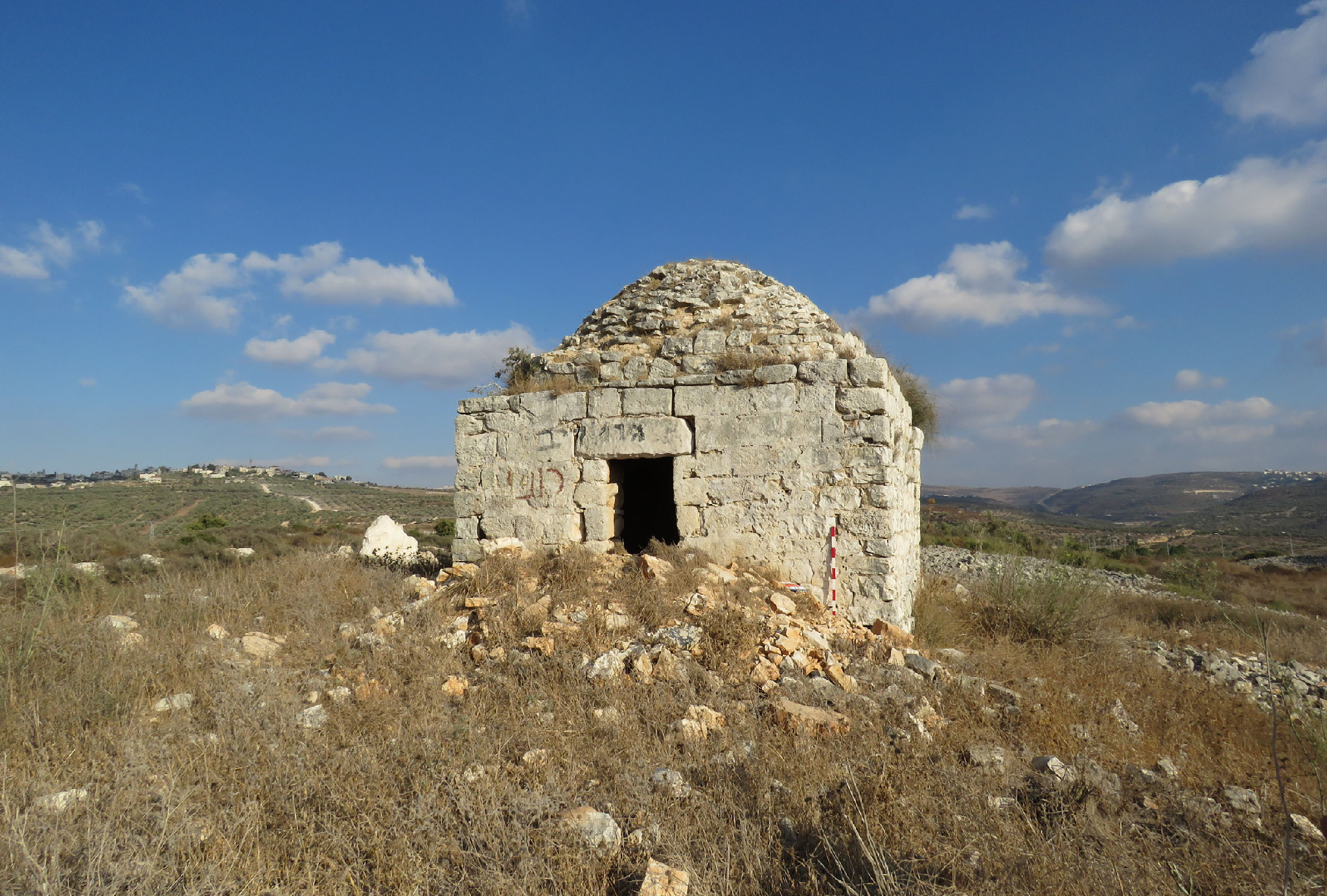
T. Canaan writes in his book on the Palestinian Muslim shrines, “Many a built maqam is an open sanctuary, where the walls of the roof rest on pillars. The best example of such a shrine is that of Hasan er-Ra'i, who was supposed to have been the shepherd of the prophet Moses. Inside of a rectangular enclosure, built of stones and mortar, we see an elongated and vaulted roof which rests on six pillars, three to the north and three to the south. Between these pillars is the large tomb” (1927, 17–18).
Then T. Canaan says, “Between the two northern vaults of the shrine of Hasan er-Ra‘i (near the Nebi Musa) we read: "Mohammed Pasha, the doer of good, has erected this blessed qubbeh on Hasan er-Ra‘i, God sanctify his secret, as he (the Pasha) was returning from welcoming the Mohammedan pilgrims. He proceeded in building but found no water. But because of his high zeal, God protect him, the water was brought to the place from the village of Jericho. Thus he deserved the heavenly reward. The 1 Rabi‘ 1110 (1698 AD)"” (1927, 20).
Now there is no this inscription there. The maqam's walls and columns have been plastered and painted a few times, and now they are covered with different inscriptions left by numerous pilgrims and tourists.
View from the east

Photo of 1934

Photo of 1934

Since 19th century, this shrine has been quite popular with visitors. Apparently, this tomb was seen by the Russian traveler A. Muravyov, passing in 1830 through Nabi Musa. In his book, he noted: “Near the monastery of dervishes (Nabi Musa) are the tombs of two sheikhs with a fresh spring for passing” (1840, II 27).
V. Guérin who visited the maqam in 1863, described it as follows, “At 10:10 we are passing a small fence with the wely in the centre. The welly is topped with two little domes and, also covers the remains of the saint. This kurgan chapel is called Qabr ar-Ra‘i. Ar-Ra‘i is a friend for the Muslims and a confidant of Nebi Musa or Moses” (Samarie I 20).
V. Guérin who visited the maqam in 1863, described it as follows, “At 10:10 we are passing a small fence with the wely in the centre. The welly is topped with two little domes and, also covers the remains of the saint. This kurgan chapel is called Qabr ar-Ra‘i. Ar-Ra‘i is a friend for the Muslims and a confidant of Nebi Musa or Moses” (Samarie I 20).
C. Clermont-Ganneau says, “the kubbeh of a small wely, called Kubbet er ra‘y, “the shepherd's cupola." Here, according to local tradition, rests Sheikh Hasan, the "Shepherd of Moses"” (ARP II 48). Ar-Ra‘i is derived from Arabic and means “shepherd”.
This shrine played an important role in a seven-day religious celebration (the Nabi Musa Festival), that was celebrated annually by Palestinian Muslims, beginning on the Friday before Good Friday in the old Greek Orthodox calendar.
View from the north-east

The cenotaph

The mihrab in the south side of a rectangular fence

What is more, T. Canaan noted that Qabr er-Ra‘i has three mihrabs (1927, 14). Nowadays there is one mihrab in the maqam, which is located in the south side of a rectangular fence (15 x 10 m). According to Canaan, “Earth gathered from Qabr er-Ra‘i dissolved in water and given to cattle will guard them from disease” (1927, 110).
Route. The maqam is located 850 m to the south-west from Nabi Musa. You can reach it via an asphalt road. Since 1995 the Palestinian National Authority have been taking control over the religious complex Nabi Musa and nearby shrines.
Visited: 06.08.18
Coordinates: 31°46'52.0"N 35°25'29.6"E
Location of the object on Google Maps
References: Muravyov 1840, II 27; Saulcy 1853, II 172 (“oualy Qobr-er-Raay”); Guérin, Samarie I 20 (“Kabr er-Ra’ai”); SWP III 231; Clermont-Ganneau, ARP II 48 (“Kubbet er ra‘y”); Canaan 1927, 14, 17–19, 20, 105, 110, 199 (“Qabr er-Ra‘i”); The Archaeological Survey of Israel
Addition: Panorama
Addition: Panorama
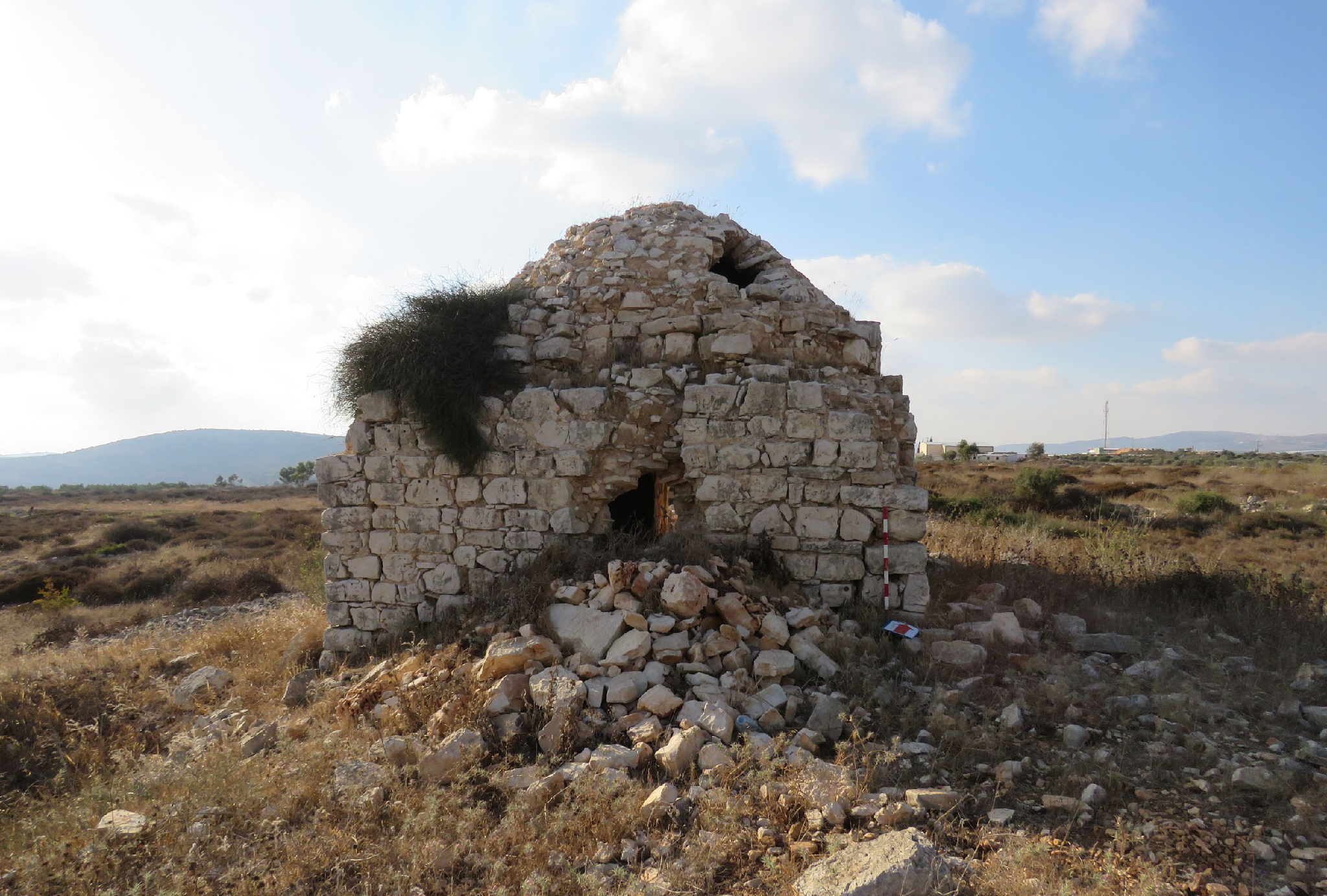
Maqam sitna ‘Aisha
مقام سيتة عايشة
קבר סתנא עיישא
Sitna (i.g. Lady) ‘Aisha was a beloved wife of Muhammad the Prophet. She was titled Umm al-Muminin (“the mother of the faithful”). She was worshipped by Sunnites as a hadith (the stories of the Prophet's life). She was traditionally buried at Jannat al-Baqi‘ cemetery in Medina. But also there is a tomb of sitna ‘Aisha in Palestine, nearby the shrine of Nabi Musa, to the east from Jerusalem.
View from the east

View from the north-west

T. Canaan called this shrine a masjid (mausoleum) and described it as follows, “Masdjid sittna ‘Aisha in the neighborhood of Nabi Musa has vault resting on four comer pillars, where the south side has been completely closed, and the eastern and western only partly built. A simple, square handsome building with the northern side completely opened, and the east and west sides partly open, stands on the site of the old enclosure. No tomb, cistern nor tree is connected with this place” (1927, 18, 61).